SWAT understands the need to display, review, interpret, and analyze data efficiently.
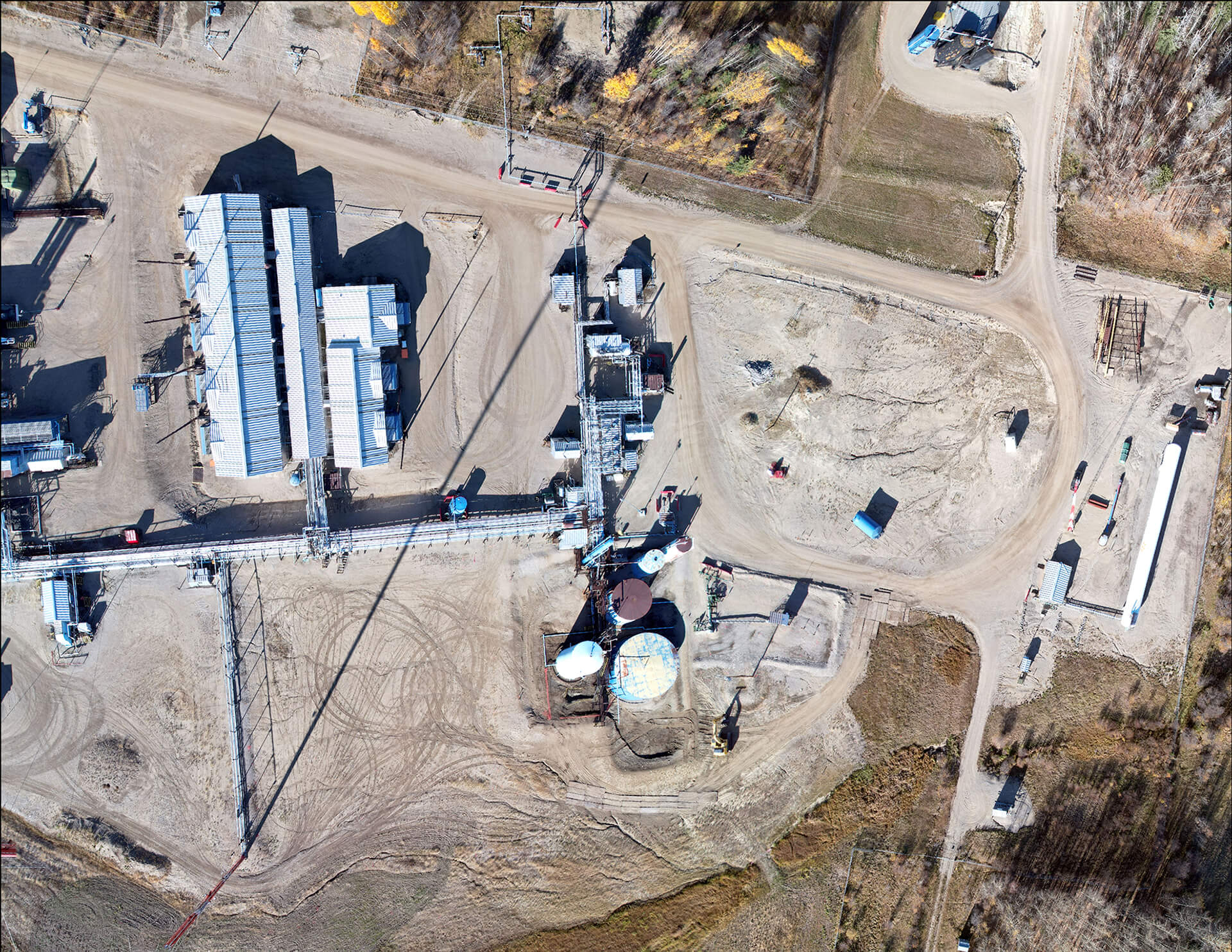
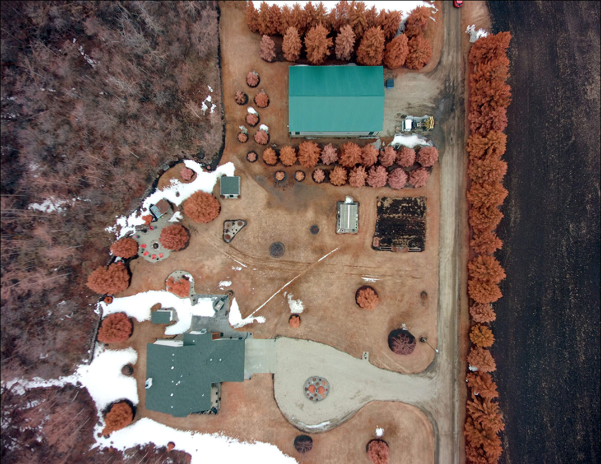
Our GIS and data management team presents information so that clients can make clear and concise decisions to meet regulatory requirements. SWAT utilizes unmanned aerial vehicles (UAVs) to capture real-time imagery and integrate it with field collected GPS and analytical data. This means our clients will always have up-to-date conceptual site figures on hand.
Environmental Data Services
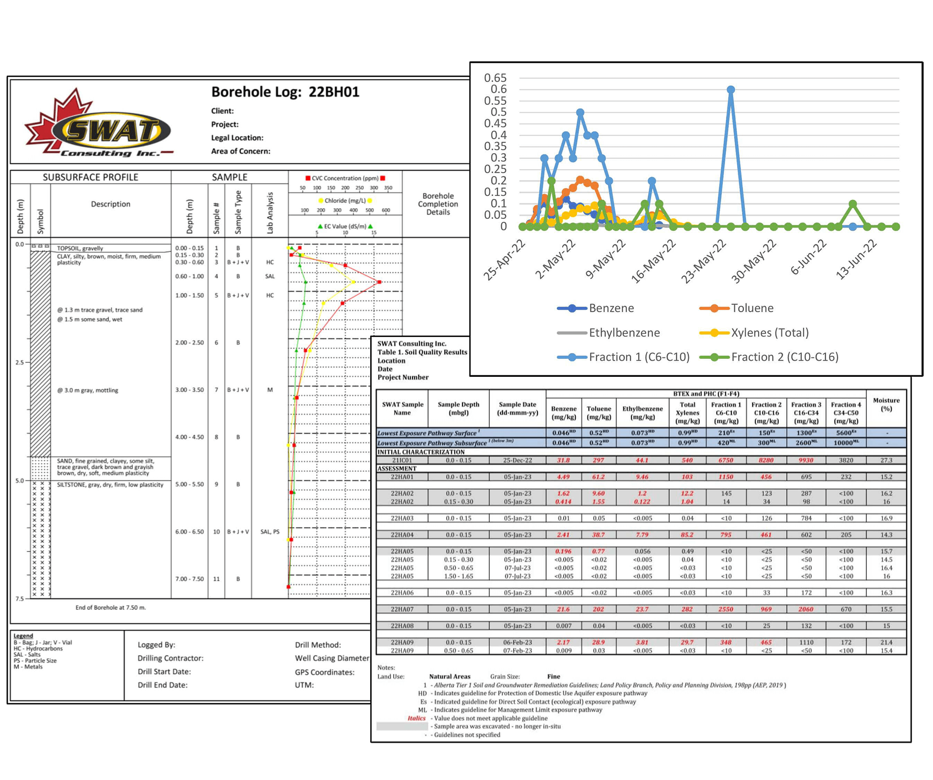
Our team of data technicians manage and organize laboratory, field, and geologic data to ensure quality and consistency. The visualizations that the team prepares are used in support of critical decision-making and project planning efforts.
Services include:
- data tabulation
- drilling logs
- graphing
- historical data organization
- statistical modelling and trend analysis
- data presentation on tables, graphs, and logs
- data analytics
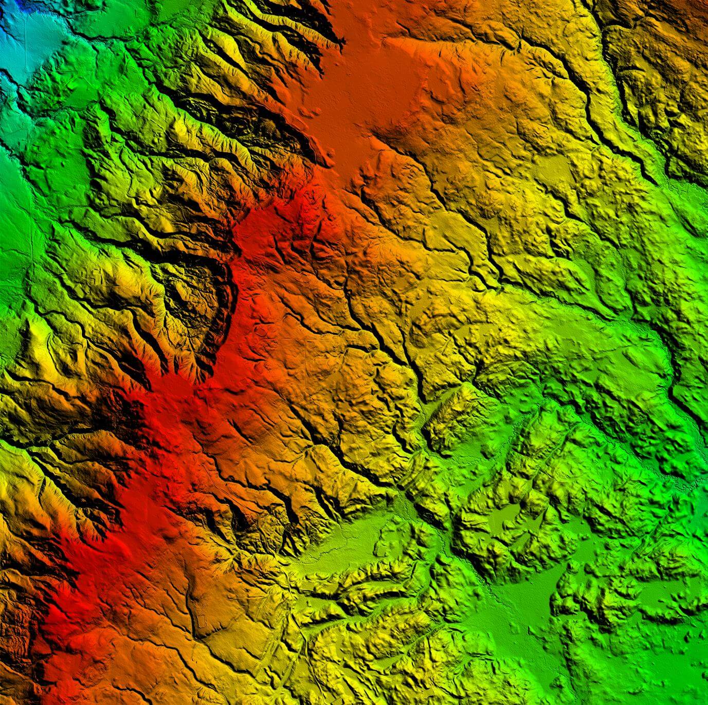
Geospatial Data Services
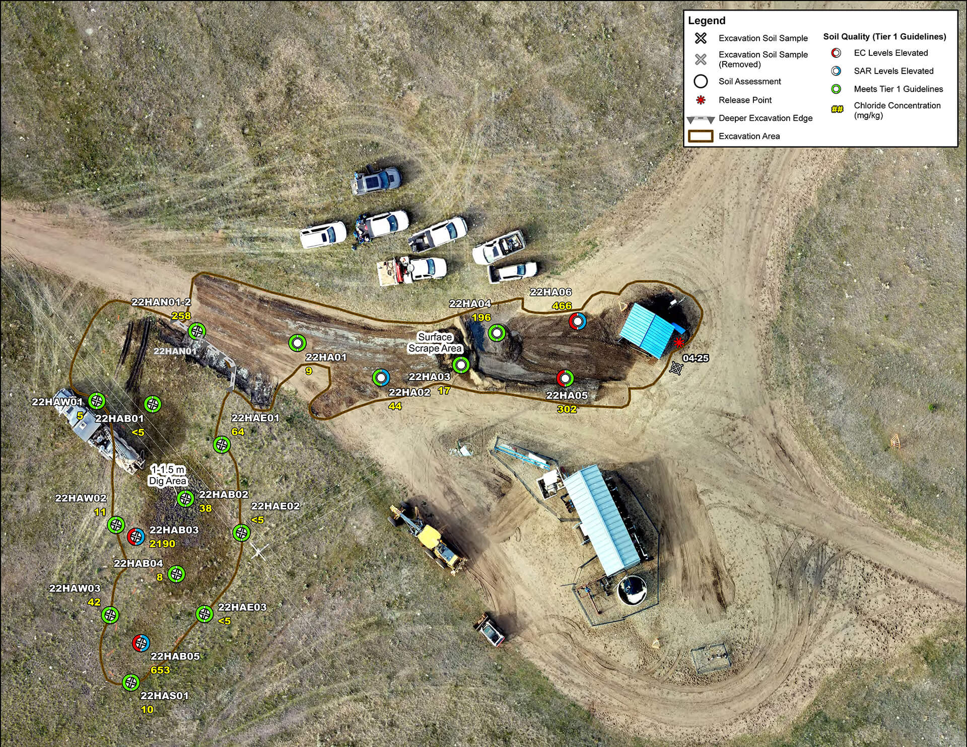
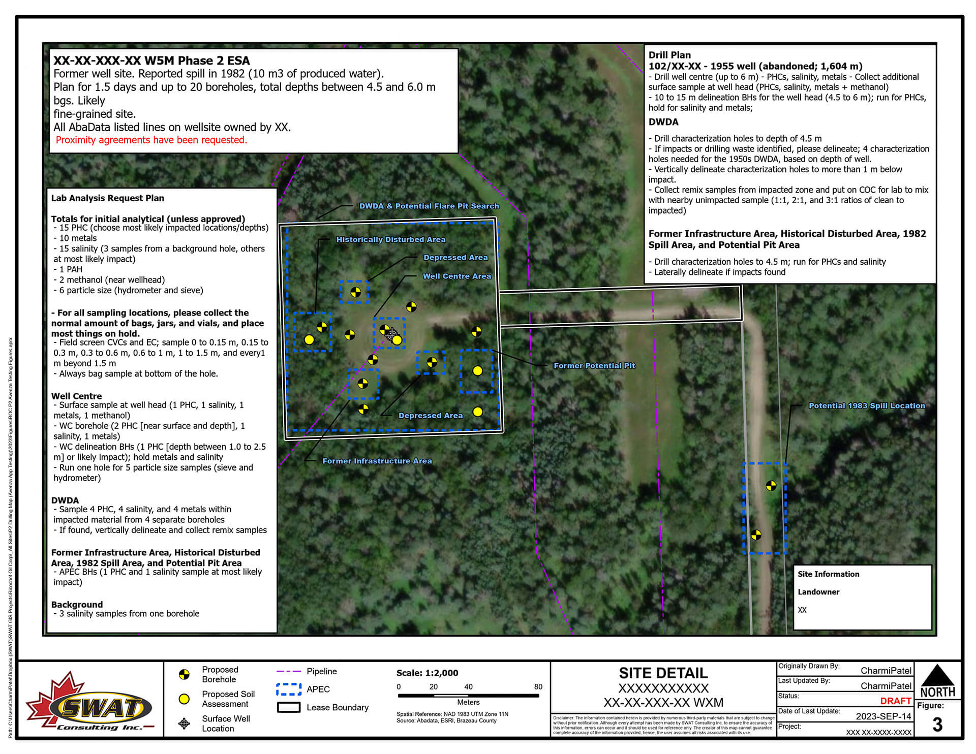
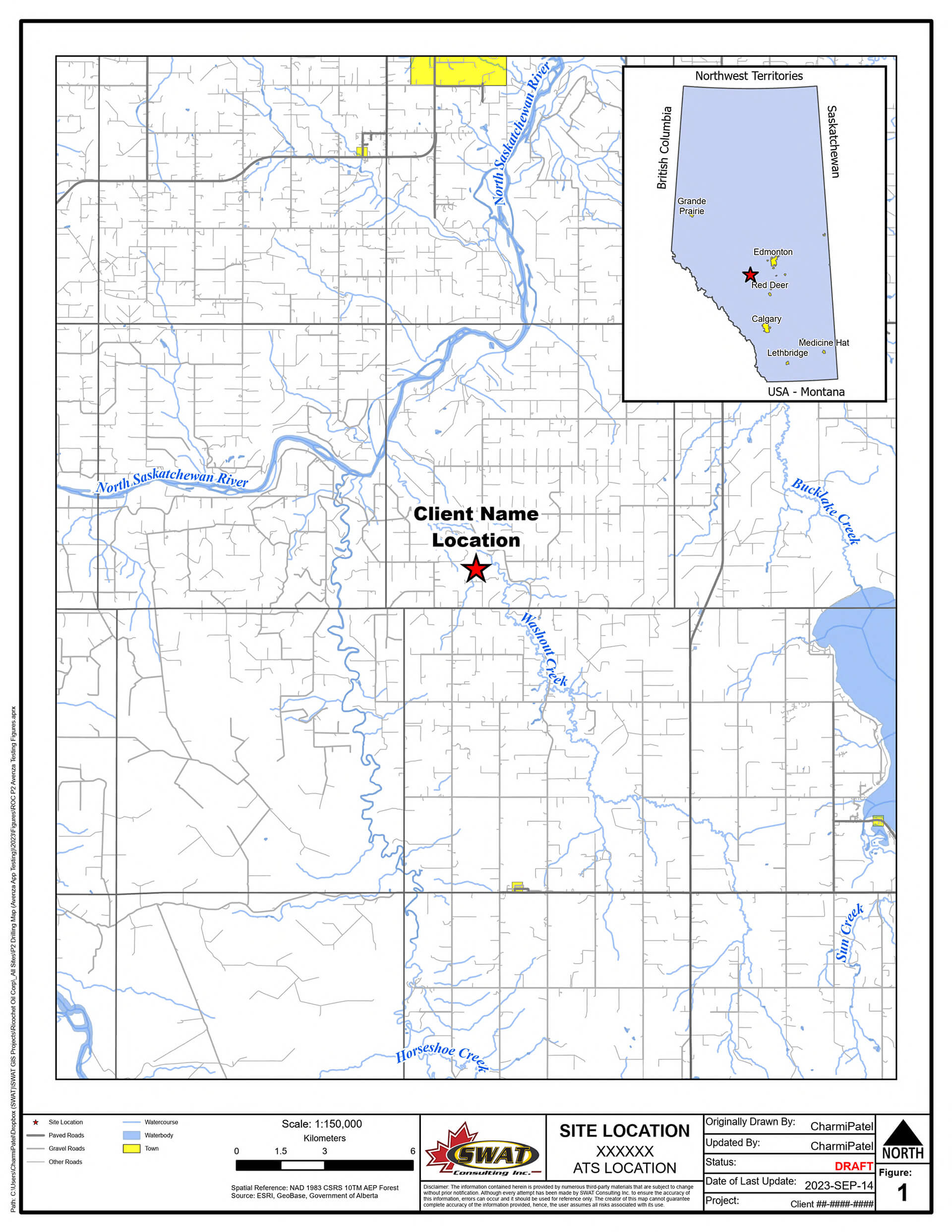
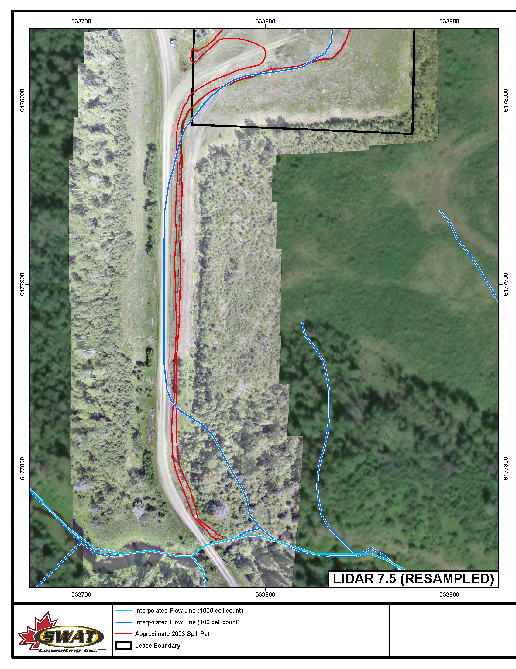
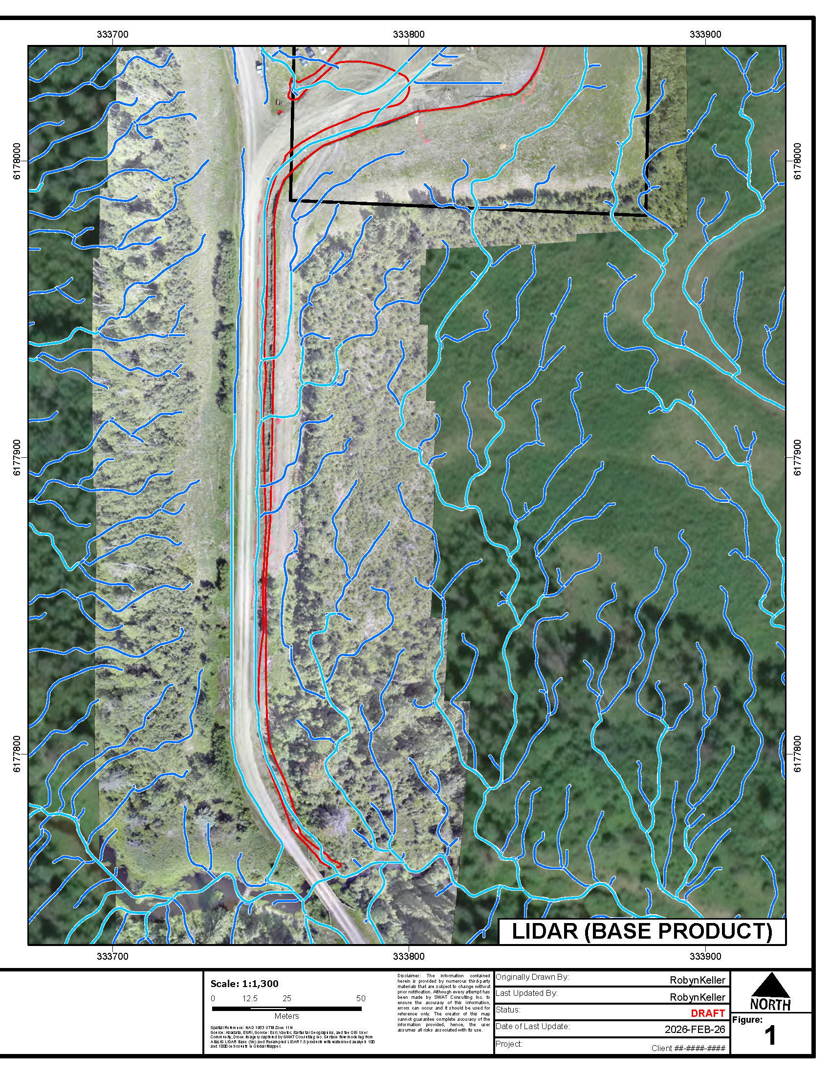
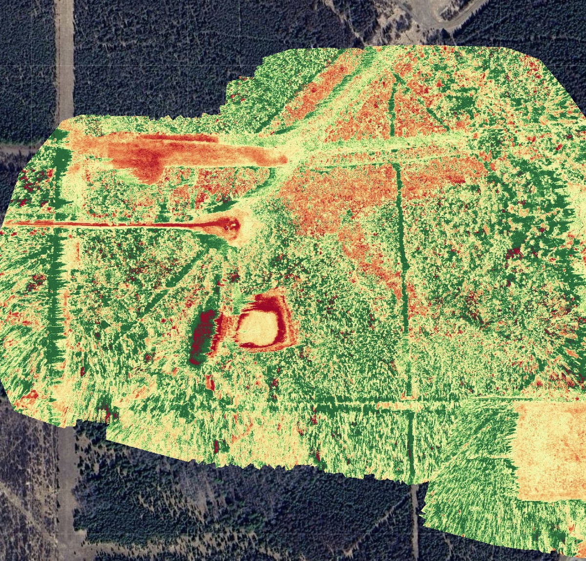
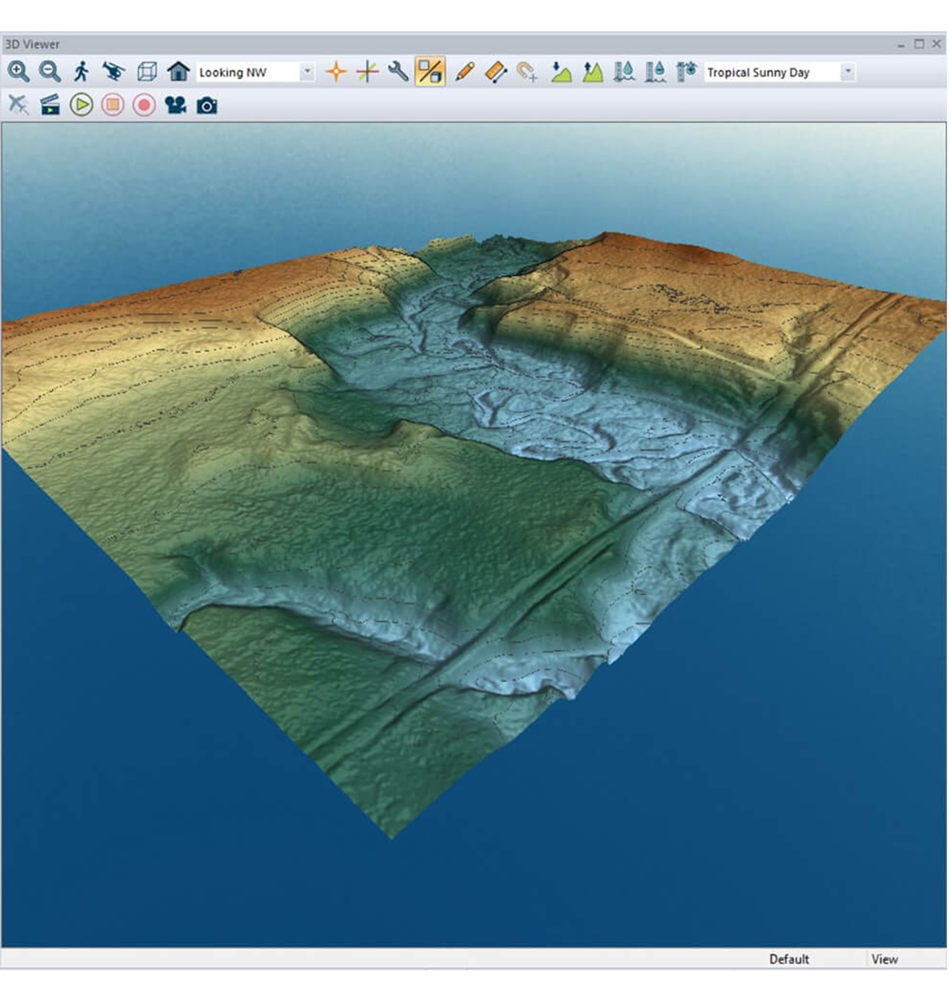
SWAT employs GIS (Geographic Information System) specialists who create figures, organize data, and analyze inputs for spatial and analytical project data. Our GIS team integrates location data with descriptive information to present geographic patterns and complex datasets and ultimately create stunning maps that tell the story of a site.
Services include:
- analysis
- cartography
- cloud-based solutions
- georeferencing
- geo-visualization
- orthomapping
- portfolio-based mapping solutions
- network analysis
- terrain modeling and surface contouring
- exceedance mapping
- land-use mapping
- web-mapping

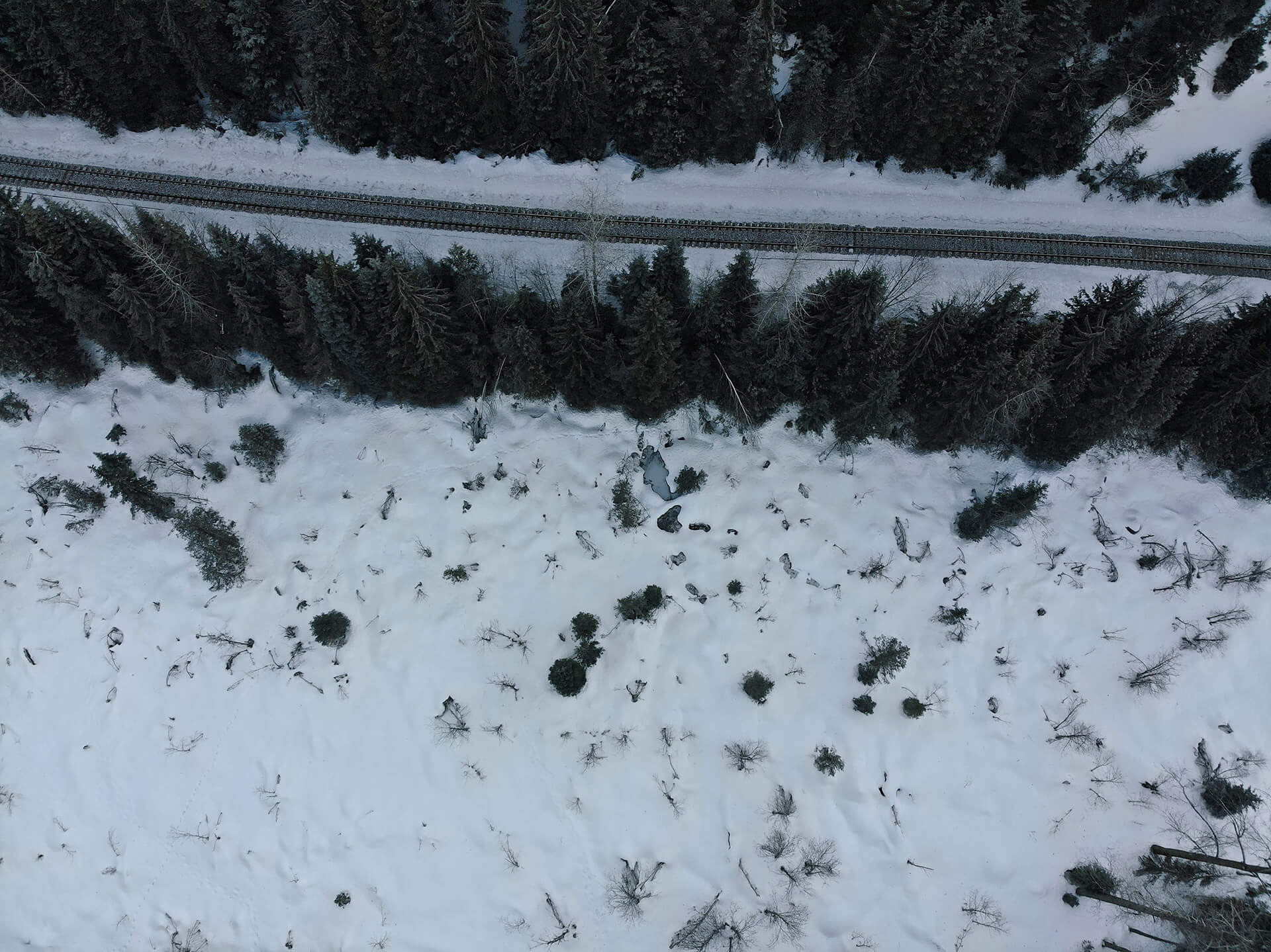
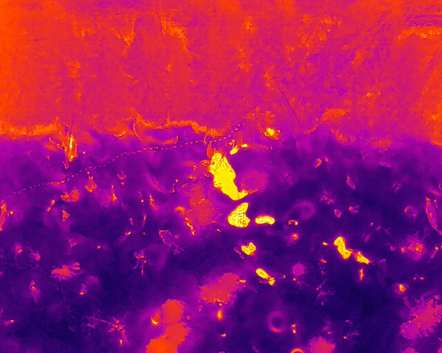
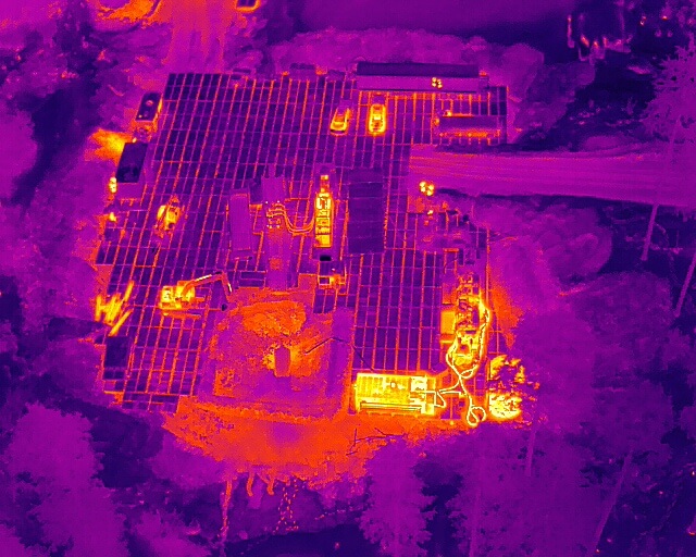
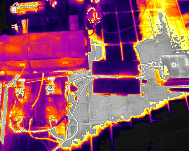
Drone Imagery
SWAT has a fleet of unmanned aerial vehicles and the required expertise and training to operate them. Our drones can be equipped with red-green-blue (RGB), near infrared (NIR), and Lidar cameras, which allows us to capture current imagery across the visible, thermal, and near-infrared spectrums. We pair aerial data with a highly accurate point-cloud dataset of elevations and surface heights. By integrating the current drone data with field collected GPS and analytical data, we can deliver up-to-date conceptual site figures to our clients.
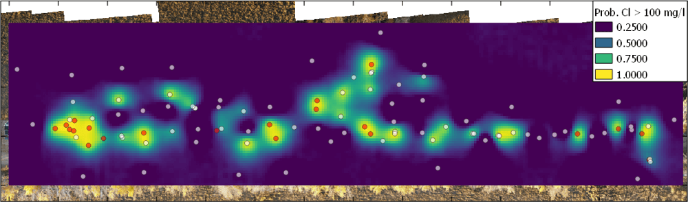
Statistical Analysis and Modelling
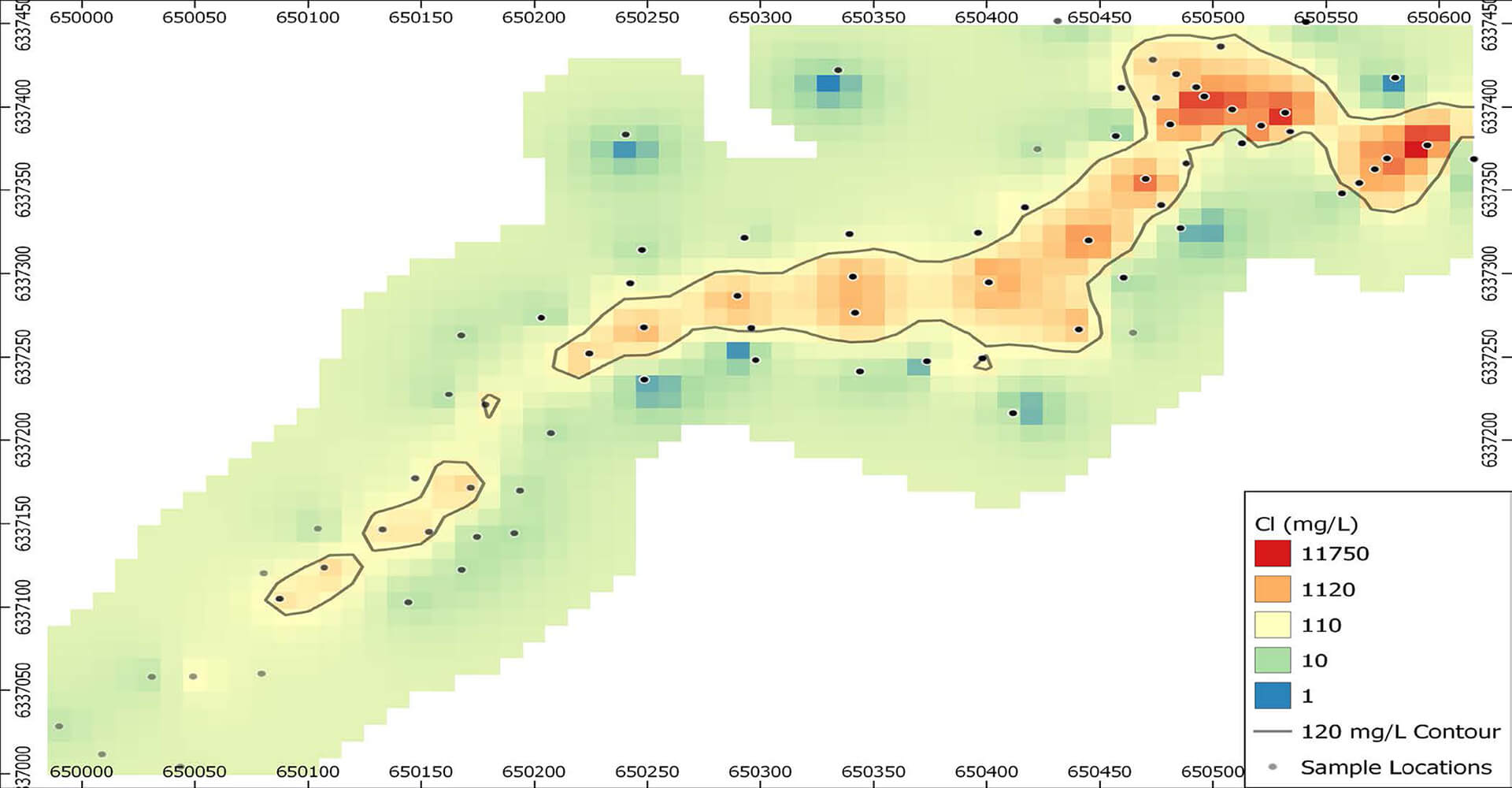
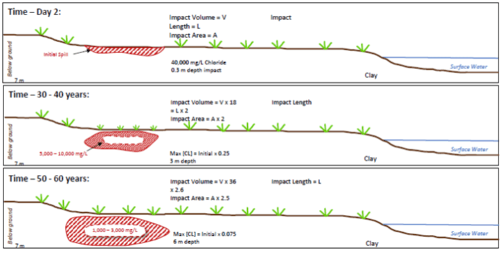
SWAT utilizes statistical analysis methods to optimize data collection, analysis, and interpretation to achieve project objectives. This allows for more effective use of collected data, provides increased certainty in data evaluation, and allows for the identification of data gaps. SWAT has developed predictive contaminant trend analysis (PCTA) methods to evaluate salinity-impacted sites. We also utilize both simple and complex numerical fate and transport models for understanding receptor risk.
Services include:
- statistical trend analysis
- contaminant plume mapping
- predictive contaminant trend analysis (PCTA)
- numerical fate and transport modelling
- data acquisition and monitoring optimization
GPS Field Data Collection
At SWAT, our team utilizes a multitude of GPS data collection methods to suit each project’s needs. Technology moves fast, and our team understands the impacts accuracy can have on site decisions and we make sure to use the right tool for the job.
